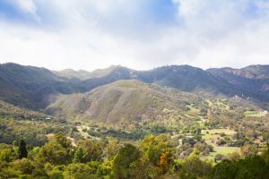
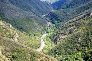
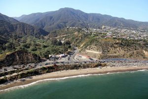
 Top O’ Topanga is located at 3360 Topanga Canyon Boulevard, State Route 27, a magnificent two-lane road that winds through rugged, steep-sided ancient rock and free-running Topanga Creek, by majestic oaks, hills, valleys, plants, and wildlife. A two and a half mile segment of Topanga Canyon Boulevard has been designated a State Scenic Highway.
Topanga is in western Los Angeles County, California, in the Santa Monica Mountains. The narrow southern portion of Topanga at the coast is between the cities of Malibu and Pacific Palisades.
Top O’ Topanga is bordered on the north by the Topanga State Park and the Top of Topanga Overlook. The Santa Monica Mountains Conservancy (SMMC) owns and manages the Overlook and park areas. Our northern neighbors include Calabasas, Woodland Hills, and Tarzana.
Across Topanga Canyon Boulevard are miles of state park that can be hiked using the Summit to Summit Motorway and more trails, including one directly across from Viewridge, our neighbors to the south, that goes to the Summit Valley Edmund D. Edelman Park.
 To our northwest is more state park, including a trail that begins at the West Mulholland Trailhead and ends at Supi.
Government and infrastructure
- Topanga is in the 3rd District of the LA County Board of Supervisors.
- The County of Los Angeles Public Library operates the Topanga Library located at 122 North Topanga Canyon Boulevard.
- The Los Angeles County Fire Department operates Fire Station No. 69 in Topanga as a part of Battalion 5.
- The Los Angeles County Sheriff’s Department (LASD) operates the Malibu/Lost Hills Station in Calabasas, serving Topanga.
- The United States Postal Service Topanga Post Office is located at 101 South Topanga Canyon Boulevard.
- The California Highway Patrol, West Valley Area, handles the traffic on the State Route and in the unincorporated areas.
- The Topanga Coalition for Emergency Preparedness (T-CEP) operates an Emergency Operations Center (EOC) near the Topanga Town Center.